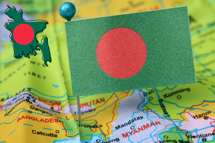
The people’s republic of Bangladesh is situated in the southern part of Asia. The country stretches from 20◦.34’ North Latitude and 88◦.01’ to 92◦.41’ East Longitude. Its area is 1,47,570 square kilometers. Bangladesh attained victory in its war of liberation against Pakistan on 16 December 1971 and emerged as an independent and sovereign state. It is one of the most densely populated countries in the world. The majority of its population depends on agriculture for a living. The world’s largest mangrove forest (Sundarbans) and longest natural sea beach (Cox’s Bazar) are located in Bangladesh.
The national flag of Bangladesh has a bottle green color as the background and a red circle in the foreground. The circle is offset slightly toward the left of the green rectangle. This makes the red circle more visible on a hoisted flag.
Bangladesh is surrounded by India on three sides – west, north, and east. The Bay of Bengal, the longest bay in the world, lies to its south and Myanmar is on its southeast side. The length of the coastal belt of Bangladesh is over 483 kilometers. It has 12 nautical miles (22.22 kilometers) of maritime boundary and 200 nautical miles (370.40 kilometers) of the exclusive economic zone. The length of the international borders of Bangladesh is 4,246 kilometers. 93.9% of the border is with India and the remaining 6% with Myanmar. Bangladesh has a close cultural bond with the West Bengal of India. Historically, these two areas were jointly known as Bengal. The people of both parts of Bengal are known as Bangalis.
Bangladesh at a glance
Official name : People’s Republic of Bangladesh
Independence Day : 26 March
Area : 1,47,570 square km
Population : 16,75,88,920 (2022)
Governmental system : Parliamentary democracy
Capital : Dhaka
State Language : Bangla
Currency : Taka
Income per capita : 1750.00 USD (2022)
Average life expectancy: 72.59 years (2019)
Literacy rate : 74.9% (15 years+) (2020)
The naming of the country:
In ancient times, there was a Janapada (territory) called ‘Banga’ in this region. Eventually, this area came to be known as Bangla. In the year 1352, Sultan Shamsuddin Ilyas Shah conquered Banga and its surroundings and renamed the whole region “Bangalah’. From around the 16th century, foreigners like the Portuguese mentioned the area as ‘Bengala’ and the English referred to it as ‘Bengal’. With the partition of India in 1947, Bengal was divided into East and West Bengal. Later, in 1955 the Pakistan government changed East Bengal’s name to East Pakistan. Finally, in 1971 East Pakistan won independence and emerged as a new state under the name of ‘Bangladesh’.
Austrics, Dravidians, Mongoloids, and other ethnic communities were the indigenous people of Bengal. Later on, Aryans and many other ethnic groups invaded this region. The Bengali nation emerged through the mixing of those races and ethnic groups.
Administrative Zones:
Bangladesh is divided into eight (8) administrative regions known as divisions. These are Barisal, Chittagong, Dhaka, Khulna, Mymensingh, Rajshahi, Rangpur, and Sylhet. There are 64 districts under these divisions. Again, the districts are divided into 495 Sub-districts or Upazillas and 652 Police stations or Thanas. Rangamati is the largest district and Meherpur is the smallest. There are 12 city corporations in Bangladesh. Two of them are present in the capital of Dhaka. There are 4,562 Unions in Bangladesh and 59,990 villages under this union. The number of households is about 20 million. Dhaka is the capital of Bangladesh. Chittagong is known as the business capital of the country. The majority of the people of Bangladesh live in the villages.
On 17 September 1974, Bangladesh became a member of the United Nations. From the secretariat building, The Government of Bangladesh runs the administration. Jatiya Sangsad (Parliament) is a unicameral legislative council. According to the constitution, the power of lawmaking is entrusted to the member of the parliament.
System of Government:
Bangladesh is a parliamentary democratic state. President is the head of the state and Prime Minister acts as the head of the government. The parliament is called ‘Jatiya Sangsad’. There are 350 members in the parliament. There hundred members are elected through a general election after every five years. These elected members select 50 female members of the parliament. The party with majority seats in the parliament nominates the Prime Minister. The members of the parliament elected President for five years.
Apart from the central government, local government also exists in Bangladesh. For instance, in the rural areas, there are Union Parishad and Upazilla Parishad. Local government bodies for the urban areas are Poura Shabha and City Corporation. Activities of these institutions are focused on the development of their localities.


